1640 - Robin Hood's Elm (Woodstock): Difference between revisions
From International Robin Hood Bibliography
m (Text replacement - "=== Record ===" to "== Record ==") |
m (Text replacement - "|width=34%}}<div class="pnMapLegend">" to "|width=34%|service=leaflet}}<div class="pnMapLegend">") |
||
| Line 7: | Line 7: | ||
|data3=Robin Hood's Elm [Oxford Street, Woodstock, Oxfordshire] | |data3=Robin Hood's Elm [Oxford Street, Woodstock, Oxfordshire] | ||
}} | }} | ||
{{#display_map:51.848371,-1.354863|width=34%}}<div class="pnMapLegend">Oxford Street, Woodstock.</div> | {{#display_map:51.848371,-1.354863|width=34%|service=leaflet}}<div class="pnMapLegend">Oxford Street, Woodstock.</div> | ||
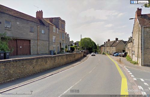
[[File:oxford-street-woodstock-google-earth-street-view.jpg|thumb|right|500px|Oxford Street, Woodstock / Google Earth Street View.]] | [[File:oxford-street-woodstock-google-earth-street-view.jpg|thumb|right|500px|Oxford Street, Woodstock / Google Earth Street View.]] | ||
<p id="byline">By Henrik Thiil Nielsen, 2017-09-21. Revised by {{#realname:{{REVISIONUSER}}}}, {{REVISIONYEAR}}-{{REVISIONMONTH}}-{{REVISIONDAY2}}.</p> | <p id="byline">By Henrik Thiil Nielsen, 2017-09-21. Revised by {{#realname:{{REVISIONUSER}}}}, {{REVISIONYEAR}}-{{REVISIONMONTH}}-{{REVISIONDAY2}}.</p> | ||
Revision as of 09:18, 5 April 2019
| Record | |
|---|---|
| Date | 1640 |
| Topic | Robin Hood's Elm [Oxford Street, Woodstock, Oxfordshire] |
Oxford Street, Woodstock.
By Henrik Thiil Nielsen, 2017-09-21. Revised by Henrik Thiil Nielsen, 2019-04-05.
Record
| Of Bartholomew Love for the lopp of Robbin Hoodes elme 18s and for 7 asshes sould out of Forrestes backside 36s. For the shrewde of the trees 5s. nexte to Richardsons house neere the hollowaye. | 2 19 0[1] |
Source notes
IRHB's brackets. The MS source is Woodstock Chamberlains' Accounts for 21 Dec. 1639 – 21 Dec. 1640. The items cited are receipts.[2]
IRHB comments
For discussion, see the page on Robin Hood's Elm (Woodstock).
Lists
- Not included in Sussex, Lucy, compil. 'References to Robin Hood up to 1600', in: Knight, Stephen. Robin Hood: A Complete Study of the English Outlaw (Oxford, UK; Cambridge, Massachusetts: Blackwell, 1994), pp. 262-88.
Sources
- Maslen, Marjorie, ed.; [Schwarz, Conny, transcr.]; [Day, Christopher, introd.] Woodstock Chamberlains' Accounts, 1609-50 (Oxford Record Society, vol. 58) (1993), p. 184; and see p. 183 for date.
Background
Also see
- 1608 - Robin Hood's Elm (Woodstock)
- 1618 - Robin Hood's Elm (Woodstock)
- Robin Hood's Elm (Woodstock).
Notes
- ↑ Maslen, Marjorie, ed.; [Schwarz, Conny, transcr.]; [Day, Christopher, introd.] Woodstock Chamberlains' Accounts, 1609-50 (Oxford Record Society, vol. 58) (1993), p. 184.
- ↑ Maslen, Marjorie, ed.; [Schwarz, Conny, transcr.]; [Day, Christopher, introd.] Woodstock Chamberlains' Accounts, 1609-50 (Oxford Record Society, vol. 58) (1993), p. 183.

