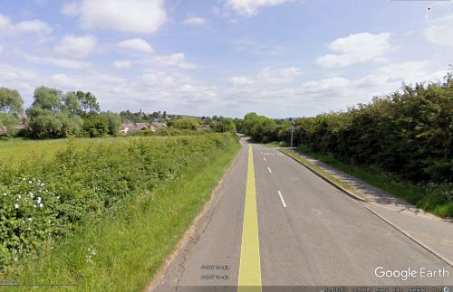
Barnsdale (Great Easton)
| Locality | |
|---|---|
| Coordinate | 52.525315, -0.755294 |
| Adm. div. | Leicestershire |
| Vicinity | Between Great Easton and Bringhurst |
| Type | Area |
| Interest | Miscellaneous |
| Status | Extant |
| First Record | 1505 |
By Henrik Thiil Nielsen, 2017-08-24. Revised by Henrik Thiil Nielsen, 2021-02-13.
A shallow valley between Great Easton and Bringhurst – two villages in the Harborough district of south-east Leicestershire – is known as Barnsdale. First mentioned in 1505, as 'Barnesdale', the name appears as an element in two derived toponyms: 'Barnsdale strete (infra villam de Eston)' (1547) and 'Barnesdale Soke' (1548). The former "refers to the lost Roman road [...] which ran from Via Devana (Gartree Road) at a junction just south-east of Medbourne via Drayton, Great Easton, Caldecott in Rutland and King's Cliffe in Northants. to meet Ermine Street at Durobrivae (Water Newton)". The first element in the name 'Barnsdale' is a reflex of either of the OE personal names 'Beorn' or 'Beornhard'.[1]
If one wanted – though this is a dubious proposition – to suggest that Robin Hood's stamping ground of Barnsdale had originally been another locality of that name than that in South Yorkshire, Barnsdale between Great Easton and Bringhurst would be a rather better candidate than the locality of the same name near Exton (Rutland). First recorded in 1505, the Leicestershire locality most probably was known as Barnsdale in the late medieval period, whereas the Rutland locality was known as Bernard's Hill during the Middle Ages and is only recorded as Barnsdale from 1579 on.
Gazetteers
- Not included in Dobson, R. B., ed.; Taylor, J., ed. Rymes of Robyn Hood: an Introduction to the English Outlaw (London, 1976), pp. 293-311.
Sources
- Cox, Barrie; Watts, Victor, introd.; Coates, Richard, gen. ed.; Cavill, Paul, production ed. The Place-Names of Leicestershire (English Place-Name Society, vols. LXXV, LXXVIII, LXXXI, LXXXIV, LXXXVIII, XC-XCI) (Nottingham, 1998-2016), pt. IV, p. 74
- NAtional Archives: Grant: Henry Collayn of Eston, co. Leicester, and John Collayn, his son, to Thomas....
Maps
- 6" O.S. map Northamptonshire XI.SW (1885; surveyed 1885)
- 6" O.S. map Northamptonshire XI.SW (1901; rev. 1899)
- 6" O.S. map Northamptonshire XI.SW (1901; rev. 1899) (georeferenced)
- 6" O.S. map Northamptonshire XI.SW (c. 1933; rev. 1899)
- 6" O.S. map Northamptonshire XI.SW (c. 1948; rev. 1938)
- 6" O.S. map Northamptonshire XI.SW (1952; rev. 1950).
Background
Also see
Notes
- ↑ All this from Cox, Barrie; Watts, Victor, introd.; Coates, Richard, gen. ed.; Cavill, Paul, production ed. The Place-Names of Leicestershire (English Place-Name Society, vols. LXXV, LXXVIII, LXXXI, LXXXIV, LXXXVIII, XC-XCI) (Nottingham, 1998-2016), pt. IV, p. 74. Italics in quotes as in Cox. IRHB's ellipsis. For 1547 entry (20 Jan. 36 Henry VIII), see NAtional Archives: Grant: Henry Collayn of Eston, co. Leicester, and John Collayn, his son, to Thomas....

